This essay was written as a student project for HIST 7250: Practicum on the Place-Based Museum.
Long Wharf and Slavery in Massachusetts
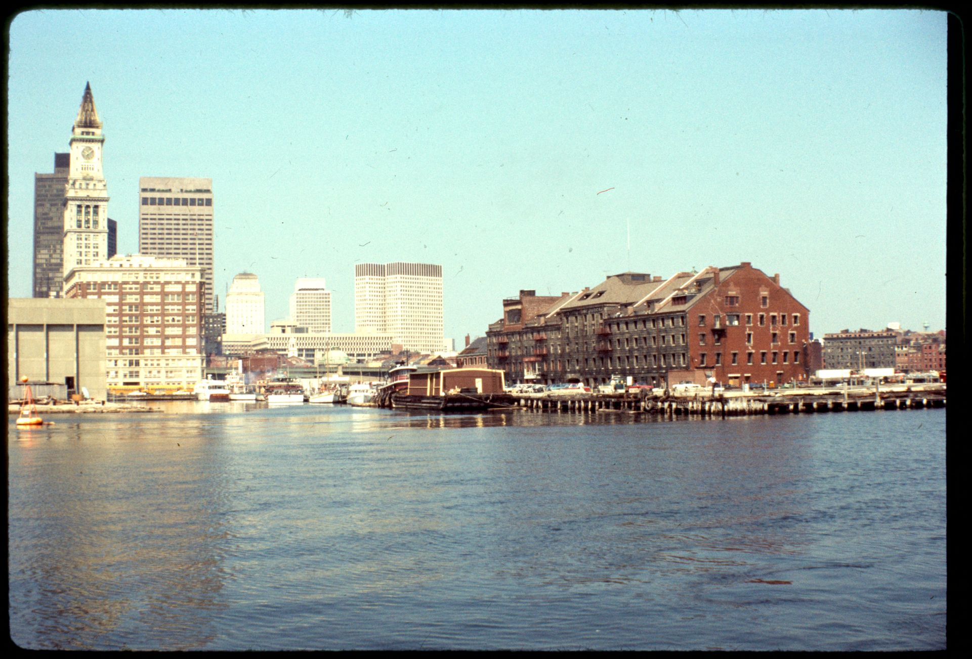
Long Wharf is one of the most fascinating spots on Boston’s waterfront. Stand at the edge, you’ll feel the breeze off the harbor and see ferries heading toward the Boston Harbor Islands. Behind you, a cluster of glass and brick structures reveals the city’s intertwined heritage of history and modernity. In the midst of this tranquil and beautiful scenery, it is often difficult to associate it with a solemn chapter of history that happened on this piece of land. In fact, the location and function of Long Wharf have long tied Boston to the Atlantic world, including the violence of slavery.
Long Wharf as a Gateway to the Atlantic Slave Trade
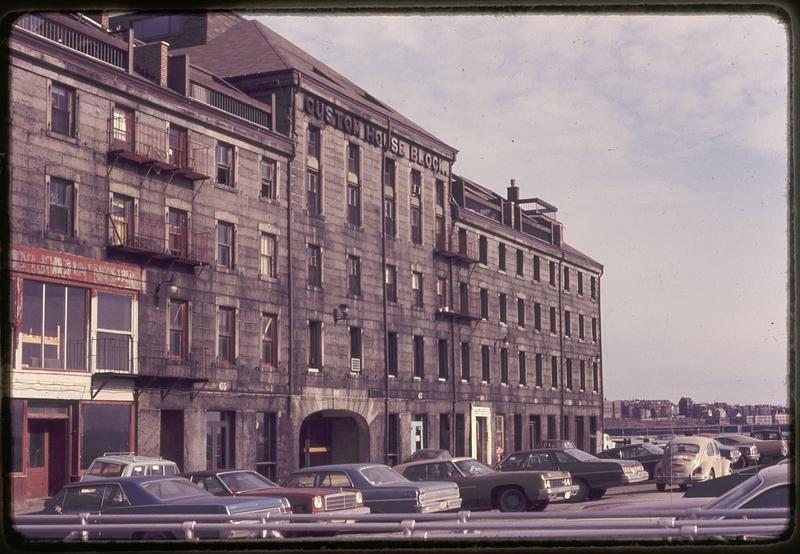
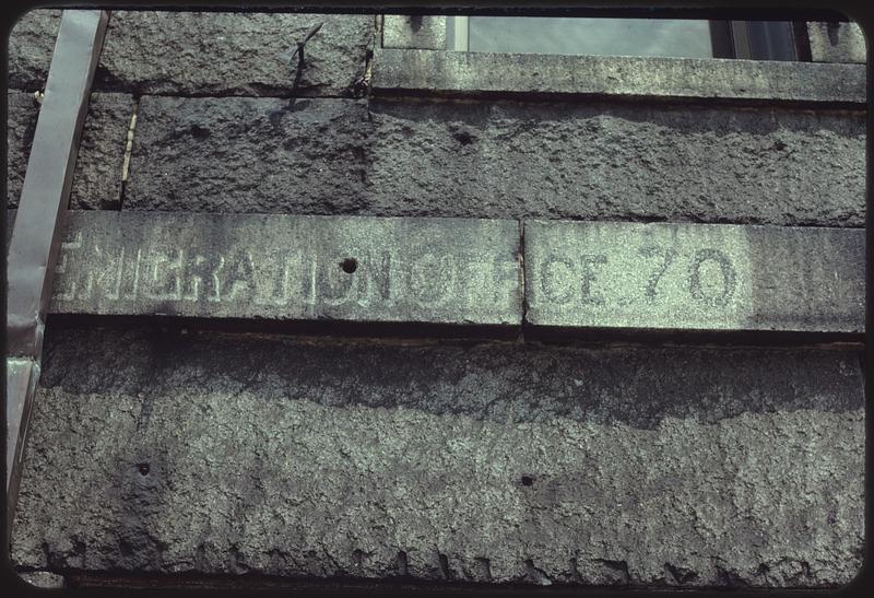
In 2020, the Middle Passage Port Marker, a permanent public marker, was installed at the end of Long Wharf to acknowledge that ships carrying enslaved people landed in Boston and to make that history visible in the landscape. This marker matters because it anchors slavery to a recognizable place. Standing by the edge of the water, facing the harbor on one side and pointing toward State Street on the other, it demonstrates how the seafront connected the transatlantic slave trade with Boston’s commerce and daily life.
Enslavement in Massachusetts began shortly after the Pequot War of 1637. That year, Governor John Winthrop recorded that hundreds of Pequots had been killed or captured, and that several Indigenous captives were sent to the Caribbean. In February 1638, the Desire returned to Boston with cotton, tobacco, and the colony’s first documented arrival of enslaved Africans.
“We sent fifteen of the boys and two of the women to Bermuda, by Mr. Pierce… Mr. Pierce, in the Salem ship, the Desire, returned from the West Indies after seven months… and brought some cotton, and tobacco, and negroes, etc., from thence.”
— Governor John Winthrop, Journal, 1637–1638
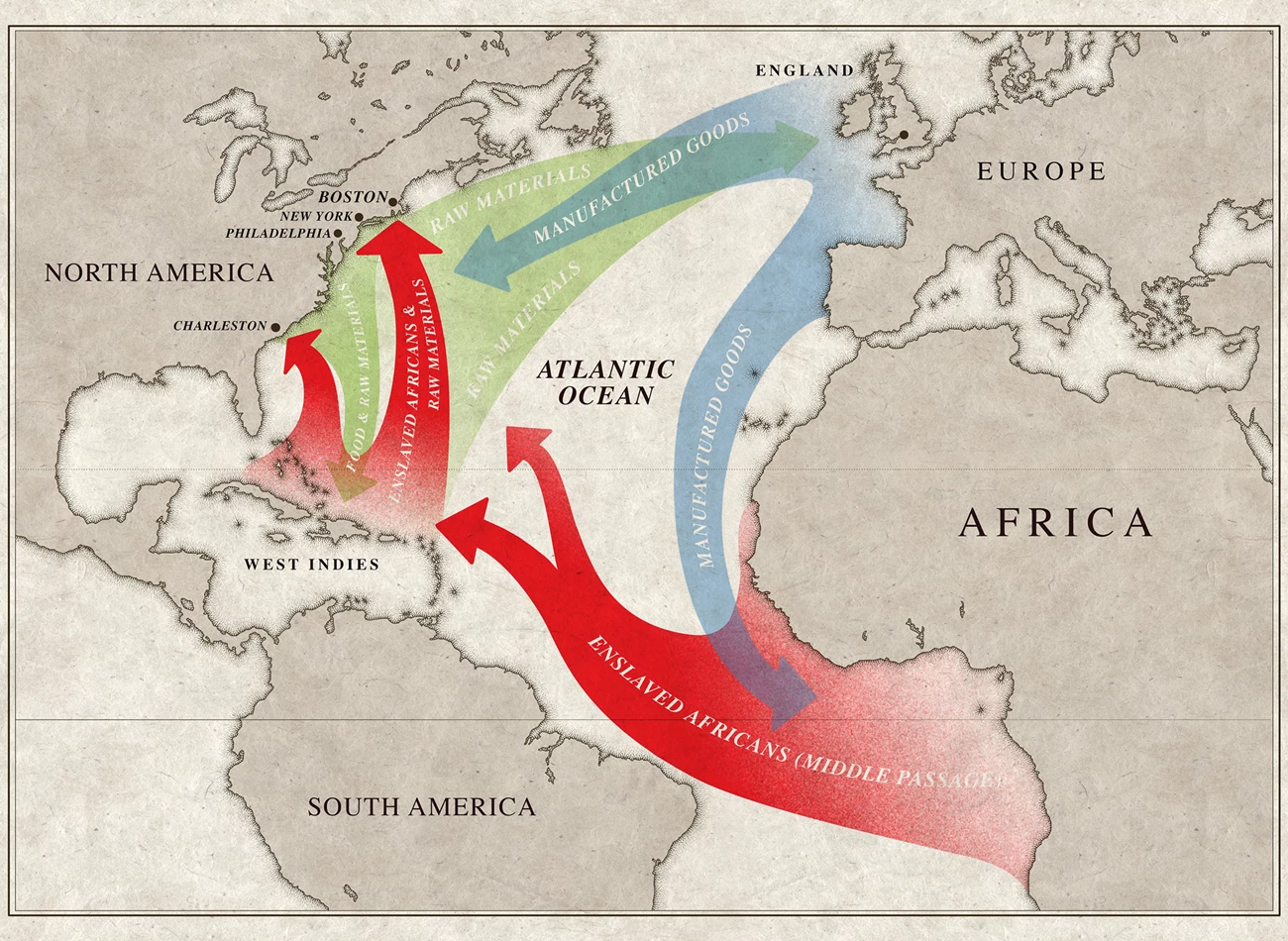
Figure 1. Map of the Middle Passage. Source: National Park Service.
Within just three years, Massachusetts legalized the enslavement of Africans, Native Americans, and mixed-race people in its 1641 Body of Liberties.
“There shall never be any bond slavery, villinage or captivity amongst us unless it be lawful Captives taken in just wars, and such strangers as willingly sell themselves or are sold to us. And these shall have all the liberties and Christian usages which the law of God established in Israel concerning such persons does morally require. This exempts none from servitude who shall be judged thereto by Authority.”
— Massachusetts Body of Liberties, 1641, Article 91
North America legalized slavery, and the institution continued to exist in the colony for roughly 150 years before it was eventually abolished in the late eighteenth century.
Trade, Labor, and the Atlantic Economy
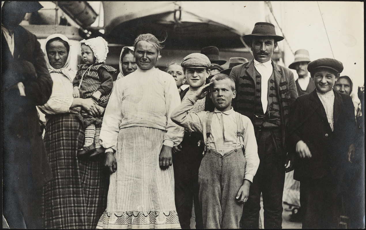
Boston’s connection to slavery was deeply rooted in the broader Atlantic trading system that shaped the city’s early economy. Between 1525 and 1866, about 12.5 million Africans were forcibly transported across the Atlantic. Through the triangular trade, European goods were exchanged in West Africa for enslaved people, who were then sent to plantations in the Americas to produce export commodities.
As a small part of this vast system, Boston became deeply connected to the plantation economies of the Caribbean. In fact, sugar colonies like Barbados focused almost entirely on exporting plantation crops, with little land devoted to food cultivation. Consequently, they relied heavily on external suppliers for food, building materials, livestock, and other necessities. Merchants, fishermen, and farmers in New England quickly recognized this demand, and Boston developed into a major port in the trade with the Caribbean islands.
Within the commodities, one of the most important exports was salted cod. This kind of salted fish was often rejected in local and European markets but widely used to feed enslaved plantation laborers in the West Indies. In return, ships arriving in Boston brought valuable commodities such as sugar and molasses. These imports were then distilled into rum in Boston’s distilleries, creating one of New England’s most profitable industries. Over time, this trade formed a cycle that directly linked Boston to the transatlantic slave trade system. Ships departing from Boston Harbor carried rum and other goods to the African coast, where they were exchanged for enslaved Africans. These slaves were transported to plantations in the Caribbean, where they were exchanged for sugar and molasses. Ultimately, the sugar and molasses were then shipped back to New England, where it was distilled into more rum.
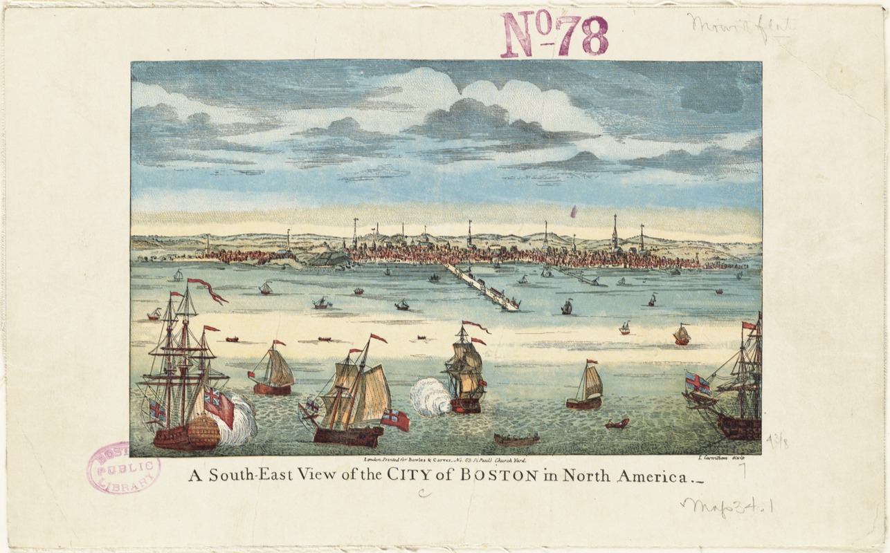
Figure 2. A south-east view of the City of Boston in North America, Boston Public Library Digital Collections.
From Slave Economy to Abolition
By the eve of the American Revolutionary War, criticism of slavery was growing within Massachusetts. Some white New Englanders began questioning the moral contradiction between the language of liberty and the continued acceptance of slavery. More importantly, both free and enslaved Black Bostonians actively challenged the institution of slavery itself through protests and petitions to both the colonial government and the revolutionary government in pursuit of freedom. Between 1773 and 1777, Boston’s Black residents submitted seven petitions demanding that the principles of liberty proclaimed during the Revolution be extended to them as well.
Slavery did not vanish overnight but was gradually dismantled through a series of legal challenges. In 1783, the Massachusetts Supreme Court ruled in Commonwealth v. Jennison that slavery was inconsistent with the state constitution adopted in 1780, thereby ending legal slavery in the state.

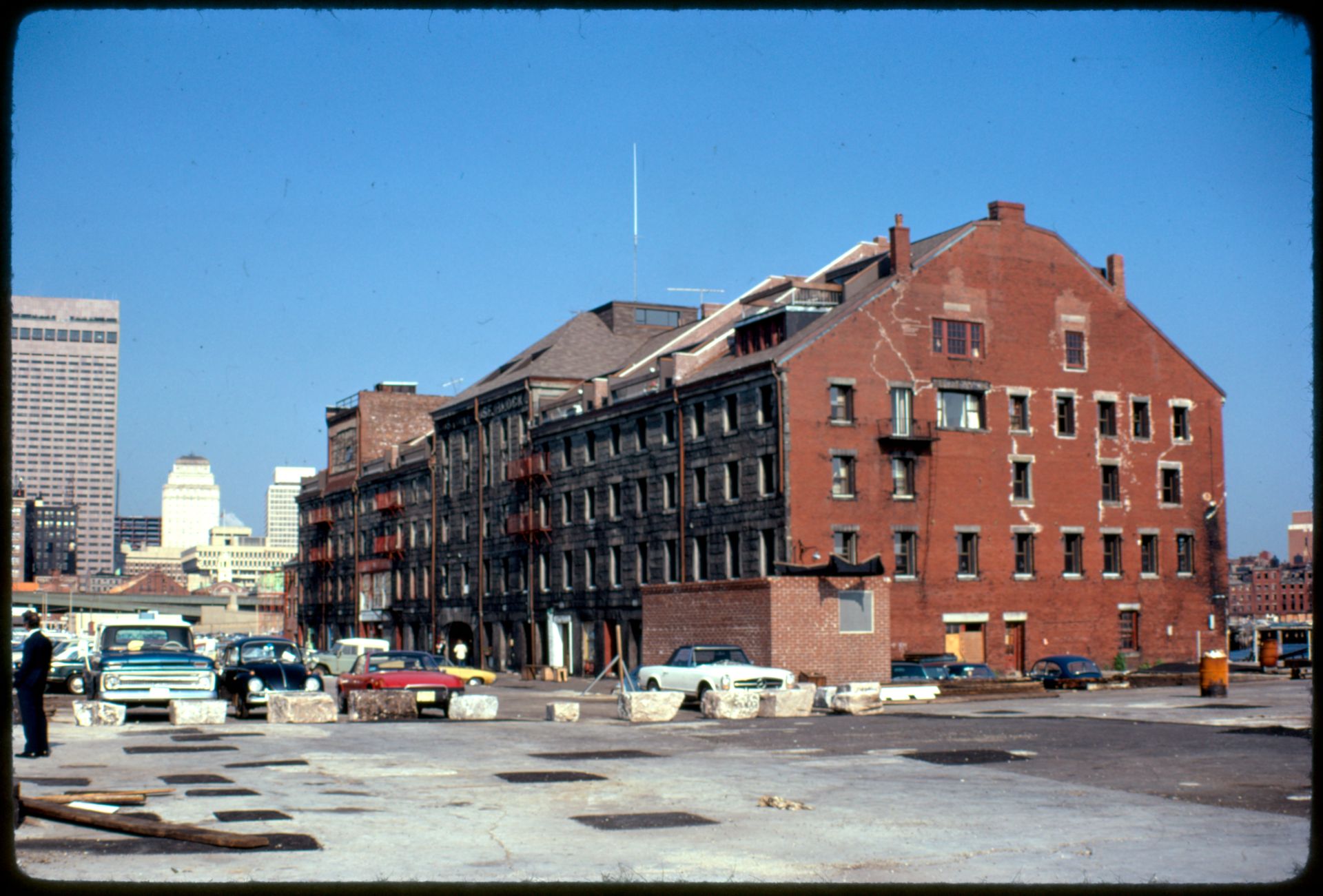
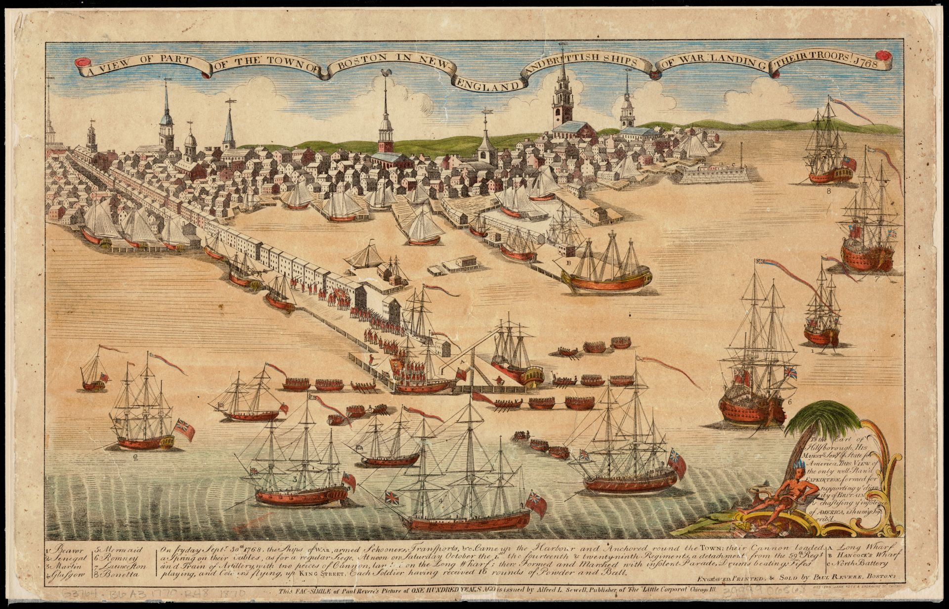
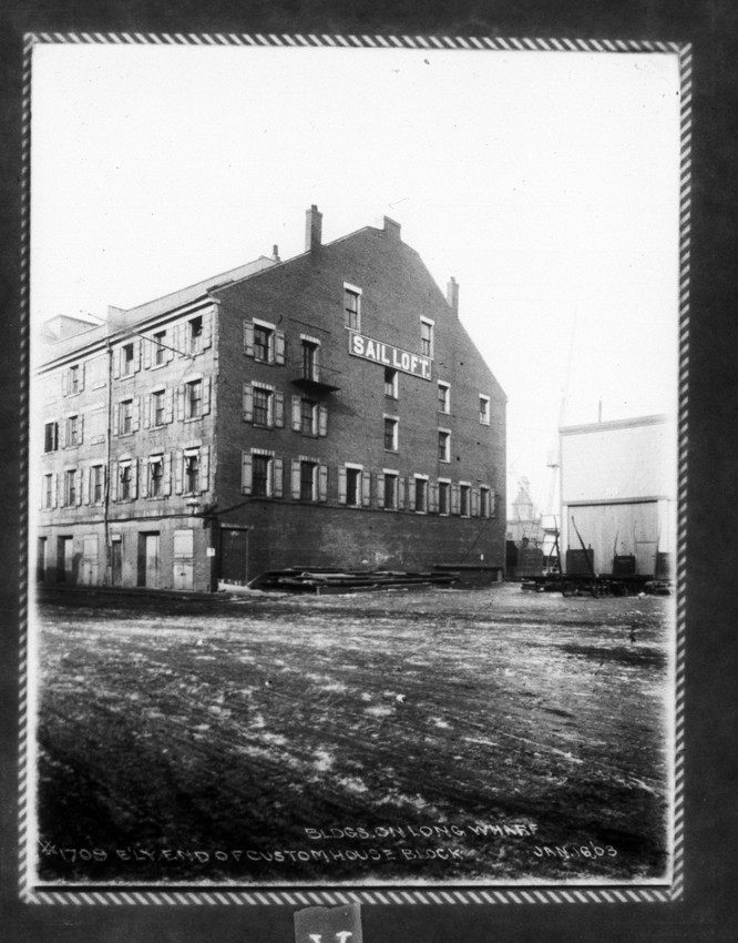
Figure 3. Historical drawing of Long Wharf, Boston Harbor.
Today, visitors stand on Long Wharf enjoying the vibrant harbor and city skyline. Yet, Long Wharf is more than just a feature of Boston’s urban landscape. It served as a physical gateway connecting the city to the wider Atlantic world, and standing here today reminds us of that piece of complex history beneath Boston’s economic prosperity and its discourse of liberty.

 Towards Beacon Hill